at the site of two huts some 200 metres south of the Kelly tree area.
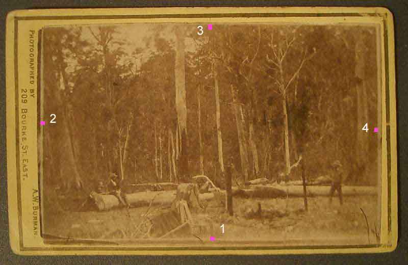
This 1878 photo by
photographer Burman of Bourke Street Melbourne is held by
VPHU museum
VPM208 Carte de Visite, A.W. Burman Stringybark Creek Re-enactment
. Reproduced with permission from the collection of Victorian
Police.
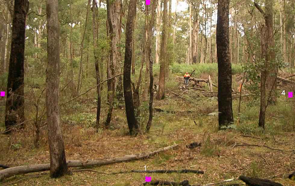
The following
image below was taken June 2009 at the same site viewed south more to the right
but essentially the same view.
Dot 4 should be closer to the standing figure with dot 2 out of the
picture left. The camera angles, lens type and height position of
the camera
are difficult to replicate. For example, the original Burman photo
above is a wide angle shot with the camera relatively low to the ground, and the
back
ground details are quite unclear due to this a poor image,
but Burman's first photo clearly shows the little hill slope as the
standing figure indicates.
Below is a panoramic view of the whole site as seen through 360
degrees. The position of the rotation point was near the
right margin.
If you cannot see an image below you may need to download Java software
from
http://www.java.com/en/index.jsp
this will only
take a few minutes.
Explanation, Pink dot 1 is the foreground of the Burman photo
behind which the Burman camera stood.
The pink lines are an indication where the left and right
photos margins would be on the ground, but
this is only an estimate as photo distortions make it difficult
to plot. In any case the area between the pink dots encompasses
the ground as depicted in the original Burman photos. As the
panorama pivots around a central point, this point is roughly
where the right hand log lay. By comparison you will notice the
skyline is more open than it was in 1878. The two vertical
white lines roughly define the area of Burman1 photo
which is shown below.

The Burman Photo of the Police camp 1878
where the troopers were shot by the Kellys
Image courtesy book by Keith McMenomy Ned Kelly- an Illustrated
history.
Image
Citation PROV Burman photo -0030-010-001- VPRS 4966
Consignment P0 Unit 2 Item 30 Record 1 Document: Photo of Wombat
Ranges where troopers were shot.
A scale map of the site can be seen at
http://pixmaker.com.au/twohuts/images/twohutsscalemap2.jpg
The central point for the panorama was near the logs junction.